I found some great late-20th Century landscaping this week tucked away in the Hampshire village of Kings Worthy. Normally on a suburban street you are confronted with a pavement and numerous driveways between front gardens. The look of the street is determined almost completely by the whims of the occupants. Each presents their own display of plants, cars, caravans, sundials etc and if the front aspect is not cared for the street scene can end up a mess.
In the photo above there is lush planting from the front gardens of the houses right up to the road completely transforming the experience from that of the typical residential street to something much greener. The pedestrian footway is set back from the road, winding through the birch trees and the houses are clustered in small groups around shared driveways so the number of driveways meeting the street is limited. The road bends around in a crescent and twice crosses the course of a disused railway line that provides open green space for ball games and dog walkers. It reminds me of something you might find in the nicer suburbs of Stockholm or Vancouver than on an ordinary estate in Britain, places where there is more space and the not-so-distant wilderness has a presence.
A flick through the police’s Secured by Design guidance would flag up some security flaws: The bushes provide places for people to hide and neither the footpath nor the road are overlooked by the houses. But the planting isn’t so dense you can’t see through it though and this condition only applies on one side of the road – there is a more conventional pavement on the other side for those who would rather be more visible. Whoever built these houses has understood that investing properly in the public realm, both in the original design and the on-going maintenance can make a vast difference to the feel of an area. I’d much rather forgo a little security to live somewhere nature feels close at hand and the street has a strong, distinctive character of its own.
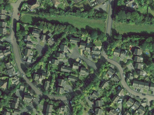
Here’s an aerial photo showing the layout – you can see 2 distinct lines of trees running top-right to bottom-left and the path of the disused railway across the top:

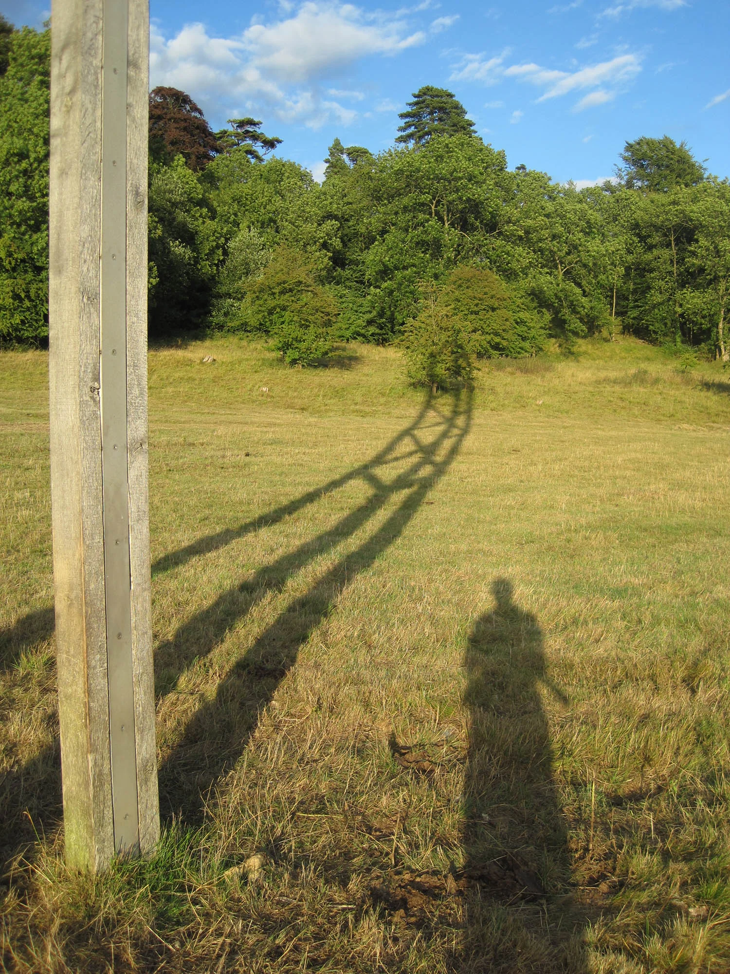
This is the point where the road crosses the disused railway:

Nearby is an older development, probably from the 1960s which also has some generous landscaping. The layout and effect are totally different. The buildings are laid out in straight lines with expansive areas of grass around them. A straight road runs down the middle of the estate with parking areas set back to group cars next to the housing blocks. The effect is of expansive green space where the dwellings gain their privacy by their separation rather than by concealment. Apart from providing separation the potential use of the grass areas seems somewhat limited. The road and the houses are too close for ball games or children to run around freely. The landscaping would be more useful it were arranged in larger pockets with more specific uses.


Behind the houses there’s pedestrian and cycle way that provides an alternative car-free, green route through part of the estate (on the left in the aerial photo above):